Toronto ravines guide
What are Toronto's ravines?
Toronto's ravine system is a network of forested river valleys — carved by the city's creeks and the Don and Humber rivers — that covers roughly 17% of the city's land area, making it the largest urban ravine system of any city in the world. Popular hiking sections include the Lower Don Trail, the Beltline Trail, Cedarvale Ravine, and Taylor Creek Park.
A hidden trail network running beneath the city grid
Toronto sits on top of one of the most extensive urban ravine systems in the world — a network of forested valleys carved by creeks and the Don and Humber rivers over thousands of years, covering roughly 17% of the city’s total land area. Most visitors never notice it, since the ravines dip below street level and stay largely hidden from the surrounding grid, but for anyone wanting a genuine hiking experience without leaving city limits, the ravine trails are Toronto’s best-kept outdoor secret.
| Where | Don Valley (east), Humber River (west), midtown ravines |
| Cost | Free |
| Time needed | 1-3 hrs per trail section |
| Getting there | Mostly walkable from TTC subway/streetcar |
| Best time | Spring/fall for comfort; year-round accessible |
Which trail fits your plans
| Trail | Terrain | Good for | Access |
|---|---|---|---|
| Lower Don Trail | Flat, paved | Runners, cyclists, first visit | Line 2 stations, Riverdale |
| Beltline Trail | Flat, former railway | Relaxed walk or bike, no elevation | Midtown, near Mount Pleasant |
| Cedarvale/Nordheimer | Mixed paved/natural | Quiet escape near St. Clair West | St. Clair West station |
| Taylor Creek/Warden Woods | Paved + rugged side trails | Longer walk, less crowded | East end, near Line 2 |
| Crothers Woods | Technical singletrack | Mountain biking | Near Brick Works, Don Valley |
Lower Don Trail — the ravine system’s backbone
The Lower Don Trail runs along the Don River from the Riverdale area down toward Lake Ontario, a mostly flat, paved multi-use path popular with runners and cyclists as well as walkers. It connects into a much larger network of Don Valley trails extending north toward the Don Valley Brick Works and beyond, and functions as a practical car-free route between several east-end neighbourhoods, not just a recreational trail.
Evergreen Brick Works — where the ravine meets a former quarry
Partway along the upper Don trails sits the Evergreen Brick Works, a former industrial brick quarry and factory converted into a public green space, market, and environmental education centre. Its network of ponds and short trails sits within a dramatic quarry bowl, and it’s one of the few points where the ravine trail system connects directly to a destination worth visiting on its own — a farmers’ market runs on weekends, and the site’s industrial-meets-nature setting is genuinely distinctive.
The Beltline Trail — a former railway through midtown
The Beltline Trail follows the route of a failed 1890s commuter railway (the Toronto Belt Line Railway operated for barely two years before going bankrupt) and today forms a flat, tree-lined multi-use path running through several midtown ravines, including sections through Moore Park Ravine and near Mount Pleasant Cemetery. Because it follows a former rail grade, it’s notably flatter and easier than most of the city’s other ravine trails, making it a good choice for a relaxed walk or bike ride without significant elevation change.
Cedarvale and Nordheimer Ravines
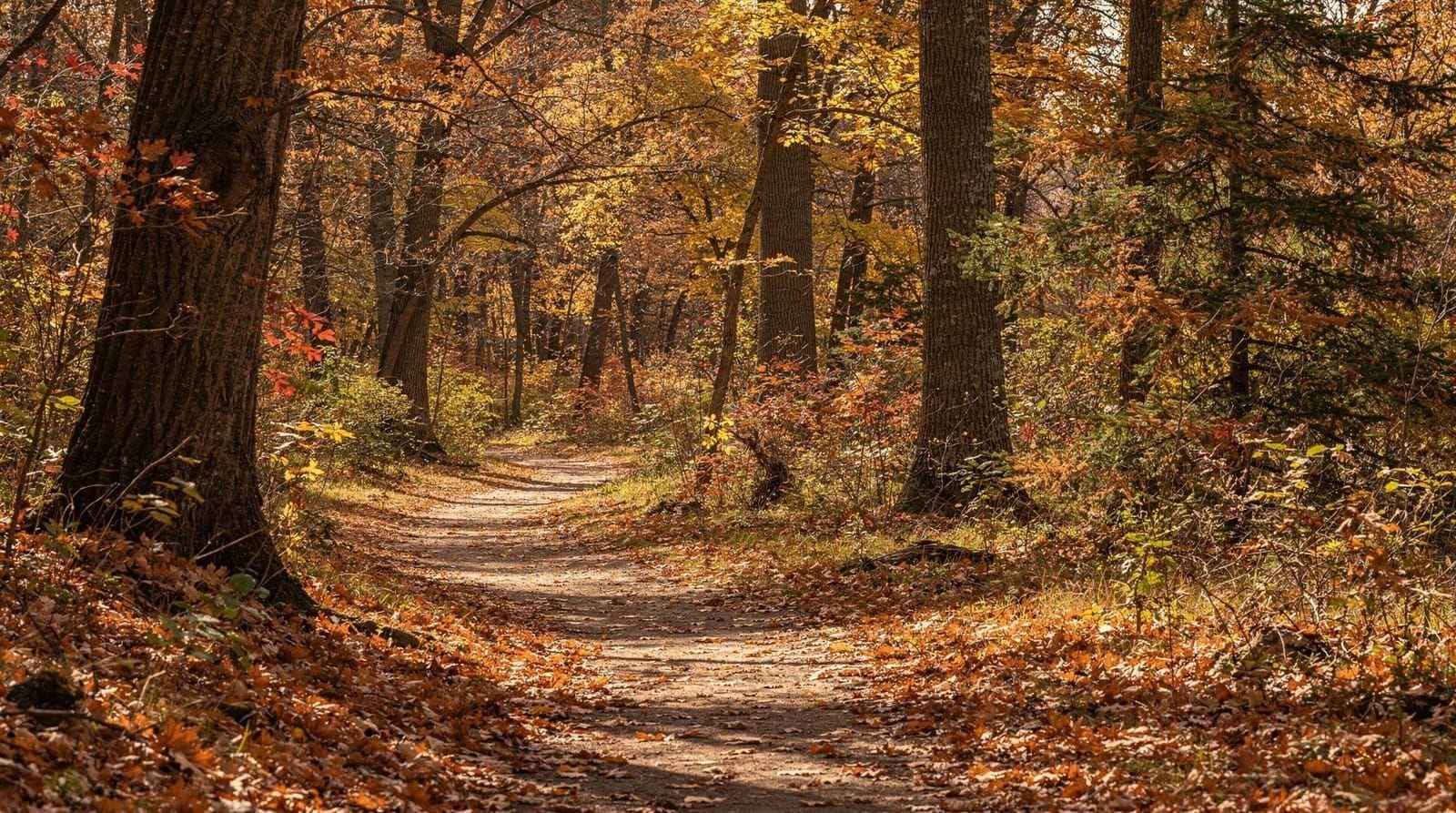
Cedarvale Ravine, connecting into Nordheimer Ravine further south, cuts through midtown near St. Clair West, with a mix of paved and natural-surface trail winding through mature forest well below the surrounding residential streets. It’s a favourite for dog walkers and a good example of how completely the ravines can disappear from view — you can be a five-minute walk from a busy commercial strip and feel entirely removed from the city.
Rosedale and Moore Park Ravines
Rosedale Ravine, running through one of Toronto’s oldest and most affluent residential neighbourhoods, offers a quieter, more intimate ravine walk with mature tree cover and glimpses of the historic homes along its rim. Moore Park Ravine, connecting toward the Beltline Trail, follows a similar character — both are examples of how the ravine system threads through the city’s most established neighbourhoods rather than being confined to the industrial or park-designated corridors most visitors expect.
Taylor Creek Park and Warden Woods
On the city’s east side, Taylor Creek Park follows Taylor Creek through a long, narrow forested valley connecting toward the Don Valley system, with a paved multi-use trail running its length. Warden Woods, a smaller adjacent ravine, adds a network of more rugged, unpaved side trails for those wanting something less manicured than the main paved path.
Crothers Woods — mountain biking terrain
Crothers Woods, within the Don Valley system near the Brick Works, is Toronto’s primary sanctioned mountain biking area, with a network of purpose-built singletrack trails maintained in partnership with local mountain biking groups. It’s a notable exception to the mostly flat, multi-use character of the rest of the ravine network — genuinely technical terrain for those who want it.
The Humber River trails — the city’s other major valley
While the Don Valley system dominates most ravine discussion, the Humber River on the city’s west side has its own extensive trail network, part of the wider Lower Humber and Humber Bay Park trail system feeding into the western waterfront. It’s less connected to the eastern ravine network but offers a similarly extensive car-free walking and cycling corridor, particularly useful for anyone based in the city’s west end.
Running and cycling the ravine network
Beyond casual walking, the ravine trails form the backbone of Toronto’s running and cycling culture, with the Lower Don and Beltline trails in particular seeing heavy use from commuting cyclists as well as recreational runners. Several running clubs organize regular group runs through specific ravine sections, and the mostly flat grades make the network genuinely useful for training distances without significant elevation change — a contrast to the steeper terrain found in most of the region’s other hiking destinations covered elsewhere in this guide series.
Safety and etiquette
Toronto’s ravines have a real history of flooding — Hurricane Hazel in 1954 caused catastrophic damage and loss of life along several of the city’s river valleys, which is part of why building has been restricted in ravine floodplains ever since. Heavy rain can still raise water levels and flood low sections of trail quickly; checking conditions before a visit during or after storms is worth doing. Poison ivy is present in several ravine sections, particularly along edges and less-maintained trails — staying on marked paths avoids most contact. Cell service is generally reliable throughout, unlike the more remote hiking destinations elsewhere in Ontario, since you’re never more than a few hundred metres from surrounding streets.
Getting around
Unlike most other hiking destinations in this guide, the ravine system is almost entirely accessible by TTC — most access points sit within walking distance of a subway station, streetcar line, or bus route, and several ravines (the Don Valley trails, Cedarvale) can be entered directly from stations along Line 1 and Line 2. This makes the ravines the most practical car-free hiking option covered anywhere in this guide. See the TTC transit guide for fares and how the subway network connects to specific ravine access points.
What to bring and wear
A ravine walk doesn’t require specialized hiking gear, but sturdy, closed-toe shoes make a real difference on the natural-surface sections of Cedarvale, Taylor Creek, and Crothers Woods, where roots and uneven ground are common even on well-marked trails. Bring water regardless of season — shade from the tree canopy makes the ravines feel cooler than the surrounding streets, which can be deceptive on a hot, humid summer day. Bug spray is worth packing between late spring and early fall, when mosquitoes are active in the wetter, low-lying sections near creek beds.
Why the ravines exist at all
Toronto’s ravine system exists in its current, largely undeveloped form partly because of the same flood risk that made Hurricane Hazel so devastating — after 1954, building within ravine floodplains was restricted across the city, effectively preserving these valleys as green corridors rather than allowing them to be filled in and built over as happened in many other North American cities during the same postwar development boom. What began as a flood-safety measure has become one of the city’s defining natural assets.
Toronto’s Ravine Strategy
The City of Toronto adopted a formal Ravine Strategy in 2017, committing to protect, invest in, and connect the ravine network as core city infrastructure rather than incidental green space — part of why trail signage and maintenance in the ravines has visibly improved in recent years, even as the system remains less internationally known than High Park or the waterfront.
For Toronto’s other major urban trail network, see the High Park trails guide and the High Park destination overview, and for a different kind of natural landscape within city limits, the Scarborough Bluffs guide covers the lakeside cliffs on the city’s east end. If you’re exploring downtown on foot and want to connect a ravine walk to the core, see the downtown Toronto walking guide.
Ravines as a rainy-day alternative to indoor plans
Light rain doesn’t rule out a ravine visit the way it can spoil an itinerary built around outdoor lookout points — the tree canopy over trails like Cedarvale and the Beltline offers real cover, and the flat, paved sections stay walkable even after a shower, unlike some of the region’s more exposed hiking destinations. A genuine downpour or thunderstorm is different: the flood history described above means it’s worth postponing a ravine walk specifically during or right after heavy rain rather than treating it as a guaranteed rain-day backup.
Frequently asked questions about Toronto’s ravines
How big is Toronto’s ravine system?
It covers roughly 17% of the city’s total land area, making it the largest urban ravine system of any city in the world, though much of it stays hidden below street level.
Are Toronto’s ravine trails safe to walk alone?
Most of the major trails (Lower Don, Beltline, Taylor Creek) are well-used and close to surrounding streets, generally considered safe during daylight hours. As with any park, it’s worth exercising the same caution you would in any urban green space, particularly after dark.
Can I bike on the ravine trails?
Yes, most of the major paved trails (Lower Don, Beltline, Taylor Creek) are multi-use and welcome cyclists alongside walkers and runners. Crothers Woods offers dedicated mountain biking singletrack for a more technical ride.
Do I need a car to reach Toronto’s ravines?
No — this is one of the ravine system’s biggest advantages over other hiking destinations covered elsewhere in this guide. Most access points are within walking distance of a TTC subway station, streetcar, or bus route.
Is there poison ivy in Toronto’s ravines?
Yes, it’s present in several ravine sections, particularly along trail edges and less-maintained paths. Staying on marked, well-used trails significantly reduces the chance of contact.
What happened to the Don Valley during Hurricane Hazel?
Hurricane Hazel struck Toronto in 1954, causing catastrophic flooding and loss of life along the city’s river valleys, including the Don. It remains one of the deadliest natural disasters in Canadian history and led to lasting restrictions on building within ravine floodplains.
Which Toronto ravine trail is best for a first visit?
The Lower Don Trail is a good starting point given its length, flat grade, and connections to the Evergreen Brick Works, offering a representative sample of the ravine system’s character without requiring detailed route planning.
Are the ravines connected to the Humber River trails?
Not directly — the Don Valley ravine network on the east side and the Humber River trails on the west side are separate systems, both extensive but not linked by a continuous trail through the downtown core.
Do I need hiking gear to walk Toronto’s ravines?
No specialized gear is needed for the paved sections like the Lower Don or Beltline, but sturdy closed-toe shoes are worth wearing on natural-surface trails like Cedarvale or Taylor Creek, where roots and uneven ground are common even on well-marked paths.