Harbourfront Toronto guide
Toronto: Harbor and Islands Sightseeing Cruise
What is there to do at Toronto's Harbourfront?
Harbourfront is Toronto's lakeside promenade running along Queens Quay, home to Harbourfront Centre's galleries and events, the free Natrel Rink for winter skating, the Toronto Islands ferry terminal, and a string of waterfront parks. It's mostly outdoor and works best paired with a ferry trip or a specific event.
Toronto’s front door to the lake
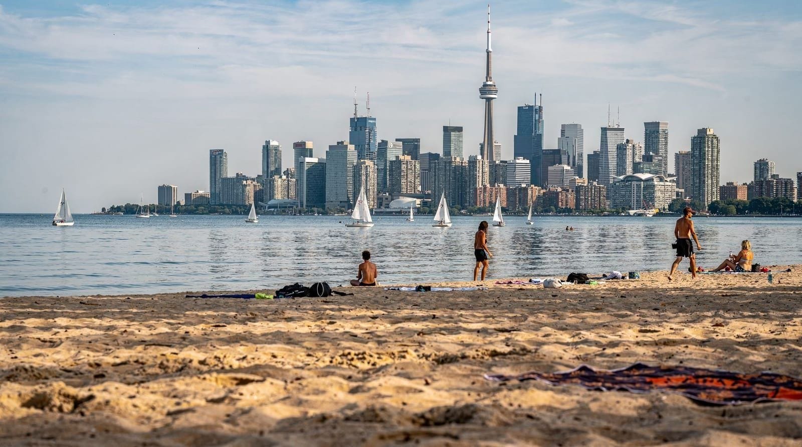
Harbourfront is the strip of waterfront running along Queens Quay from roughly the foot of Bathurst Street to Yonge Street, and it functions as Toronto’s most direct connection to Lake Ontario — the place where the CN Tower’s skyline meets open water. It’s not a single attraction so much as a loosely connected chain of parks, cultural venues, and transit points, which makes it a good add-on to a downtown day rather than a full standalone destination on its own.
| Where | Queens Quay, downtown Toronto’s lakefront |
| Cost | Free to walk; skating, cruises and galleries are optional extras |
| Time needed | 1-2 hours, longer if paired with the islands ferry |
| Getting there | 509/510 streetcar, or a 10-15 min walk south from Union Station |
| Best time | Summer for festivals, winter for the free Natrel Rink |
The area underwent a major transformation starting in the 1970s and 80s, converting a formerly industrial shipping and rail corridor into public parkland, arts venues, and residential development — a process that’s still ongoing, with new segments of the waterfront trail and public space opening in phases.
Harbourfront Centre
The neighborhood’s cultural anchor is Harbourfront Centre, a nonprofit arts organization running year-round programming — gallery exhibitions, craft studios you can watch artists working in, performance spaces, and a busy calendar of free and ticketed festivals throughout the year. The Power Plant Contemporary Art Gallery, housed in a converted power station on the site, focuses on rotating contemporary art exhibitions and is one of the more serious contemporary galleries in the city, with free admission.
The Natrel Rink
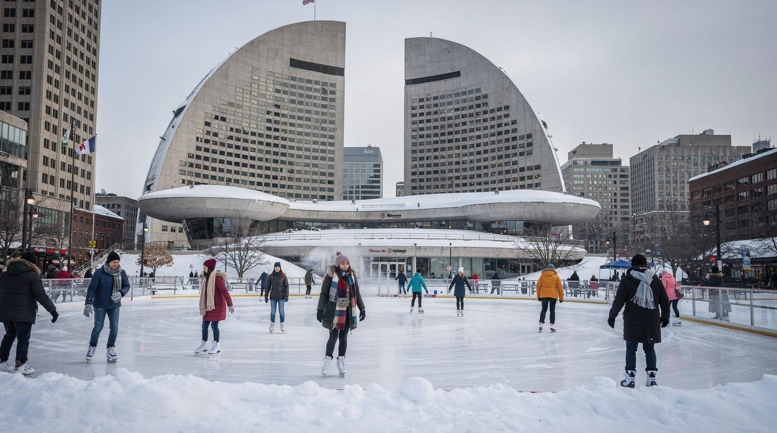
In winter, Harbourfront Centre’s outdoor rink — one of the largest artificial ice surfaces in Canada — offers free public skating with a skyline and lake backdrop that’s hard to match anywhere else in the city. Skate rentals run a modest separate fee if you didn’t bring your own. It draws both tourists and locals and gets busy on weekend afternoons and evenings, particularly around the holiday season, but rarely feels overcrowded given the rink’s size. It’s a genuinely good alternative to Nathan Phillips Square’s more famous but smaller rink if you want more space to skate — our ice skating in Toronto guide compares both rinks and a few other options around the city.
Toronto Music Garden
A short walk west of the main Harbourfront Centre complex, the Toronto Music Garden is a small, unusual public park designed in collaboration with cellist Yo-Yo Ma, with its landscaping structured to loosely follow the movements of a Bach cello suite. It’s a quiet, less-visited stop compared to the busier eastern stretch of the promenade, and a good spot for a break if the crowds elsewhere along the waterfront feel like too much.
The ferry terminal and getting on the water
The Jack Layton Ferry Terminal, at the foot of Bay Street, is the departure point for all Toronto Islands ferry service — the islands sit just offshore and are covered in full in our guide to Toronto Islands. For a longer, guided version of seeing the city from the water, the Toronto harbor and islands sightseeing cruise loops past the skyline and around the islands with narration, a good option if you want the water view without managing ferry timing and dock choices yourself.
HTO Park and the eastern promenade
East of the ferry terminal, HTO Park brings an unusual, deliberately beach-like design to the urban waterfront — sand, striped umbrellas, and Muskoka chairs set against a backdrop of condo towers, a slightly surreal contrast that’s become one of the more photographed spots along the strip. Continuing east, the promenade links up eventually with the Distillery District and St. Lawrence neighborhood, making a longer waterfront walk possible if you have the time and don’t mind the stretch through active construction zones, which have been a semi-permanent feature of this ever-developing waterfront corridor.
Getting there
Queens Quay, the street running the length of Harbourfront, is served directly by the 509 and 510 streetcars, both accessible from Union Station. It’s also a comfortable 10-15 minute walk south from Union Station down to the water if the weather cooperates. Parking directly along the waterfront is limited and metered; most visitors arrive by transit or on foot from a downtown hotel rather than driving.
When to go
Summer brings the fullest program of festivals, outdoor markets, and the warmest weather for a lakeside walk, but also the biggest crowds, particularly around any scheduled Harbourfront Centre event. Winter’s draw is specifically the Natrel Rink and a quieter, starker version of the waterfront — worth a visit if skating is the goal, less compelling if you’re mainly there for the parks and gardens, which are far less lively in the cold months. Spring and fall split the difference, with fewer crowds and mild enough weather for a comfortable walk.
Pairing it with the rest of your trip
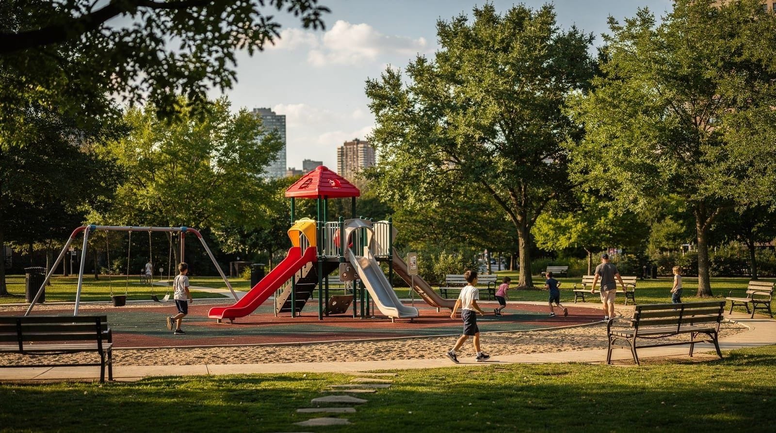
Harbourfront connects directly to the Toronto Islands via the ferry terminal, and most visitors treat the two as a single half-day or full-day outing. It’s also an easy 10-15 minute walk north to Union Station and the rest of the downtown core, covered in our downtown Toronto walking guide, making it simple to fold into a broader day rather than treating it as a separate trip. Families should also check our guide to Toronto with kids, which covers Harbourfront’s playgrounds and splash pads alongside other nearby kid-friendly stops.
From working port to public parkland
Harbourfront’s transformation from industrial waterfront to public parkland is a relatively recent story, and one that’s still not entirely finished. Through most of the 20th century, this stretch of shoreline was a working industrial and rail corridor — grain elevators, shipping warehouses, coal yards, and freight rail lines dominated the waterfront, and the lake itself was largely inaccessible to the public behind a wall of industrial infrastructure. The construction of the Gardiner Expressway in the 1950s and 60s further cut the waterfront off from downtown, reinforcing the sense that this was a working zone rather than a public space.
That began changing in 1972, when the federal government created a waterfront redevelopment corporation — the forerunner of today’s nonprofit Harbourfront Centre — with an explicit mandate to convert the declining industrial port lands into public cultural and recreational space.
It was, at the time, a genuinely unusual move — federal involvement in urban waterfront redevelopment wasn’t a common model in Canada, and the project became an early example of what’s now a familiar playbook in cities worldwide: repurposing obsolete industrial waterfront into public parkland and mixed-use development. Toronto’s version has unfolded in phases over five decades rather than as a single completed project, which is part of why the area still has a slightly unfinished, in-progress feel in places, with construction cranes a semi-permanent feature of the skyline here.
Harbourfront Centre itself was conceived from the start as an arts-focused nonprofit rather than a purely commercial redevelopment, a distinction that still shapes the area today — its programming mandate includes maintaining free and low-cost public cultural access alongside whatever commercial development happens around it, which is part of why the Natrel Rink remains free and why the Power Plant gallery has never charged admission, even as surrounding real estate values have climbed.
The Power Plant building itself is a literal artifact of the industrial waterfront it replaced — it was originally a working power station serving a nearby grain terminal’s silos, and its conversion to a gallery in the late 1980s preserved the original structure’s industrial shell rather than demolishing it, a rare case of adaptive reuse rather than teardown-and-rebuild along this stretch.
The redevelopment is nowhere near finished. Segments of the waterfront trail east toward the Port Lands continue to open in phases, and planning for the broader waterfront — including flood protection work and further residential and park development — is still active, decades after the original 1970s mandate. Visitors walking the promenade today are seeing roughly the fourth or fifth decade of a project that was never meant to have a fixed end date.
One consequence of this decades-long, phased approach is that Harbourfront doesn’t read as a single coherent design the way a purpose-built waterfront park elsewhere might — it’s more accurately described as a corridor of individually developed segments, each reflecting the planning priorities and design tastes of whichever decade built it.
The 1980s-era sections tend toward the plaza-and-institutional-building style typical of that period’s public architecture, while more recently completed stretches favor the naturalized planting and flexible public space that’s become the current standard in waterfront design. Walking the full length of the promenade end to end is, in a sense, a walk through five decades of shifting ideas about what public waterfront space should look like, layered one after another along the same stretch of reclaimed industrial shoreline.
That layered history is also why Harbourfront’s residential towers coexist so closely with its public institutions in a way that feels unusual compared to purely commercial waterfronts elsewhere. Condo development was part of the original redevelopment strategy from early on, effectively subsidizing the public cultural space through nearby land value rather than relying purely on public funding — a model that’s had genuine trade-offs, since it means much of the waterfront’s most desirable water-view real estate is private residential rather than public parkland, even as the promenade itself has remained consistently free and open.
Visitors sometimes remark on how close the condo towers sit to the public walkway; that proximity is a direct, intentional consequence of how the whole redevelopment was financed from its earliest years.
Practical notes
- Cost: Free to walk and explore; skating, boat cruises, and specific gallery exhibitions are the main optional expenses.
- Weather: The lakefront location means more wind exposure than inland downtown — dress a layer warmer than you would elsewhere in the city, especially in winter and on the water.
- Construction: Parts of the waterfront trail have been under active redevelopment for years in phases — expect occasional detours around construction fencing, particularly on the eastern stretch toward the Distillery District.
- Accessibility: The promenade itself is flat, paved, and stroller- and wheelchair-friendly throughout.
Harbourfront works best as a connective piece of a larger day rather than a destination unto itself — pair it with the islands, a downtown walk, or, in winter, an afternoon of free skating with a skyline view most cities can’t offer.
Harbourfront versus the Toronto Islands: which comes first
Visitors with limited time sometimes wonder whether Harbourfront itself is worth a separate stop if the real goal is the Toronto Islands. It generally is: the ferry queue at the Jack Layton terminal can run 20-30 minutes at peak summer times, and walking the promenade, browsing Harbourfront Centre, or grabbing a coffee at HTO Park is a far better use of that wait than standing in line with nothing to look at. The honest sequence for most people is Harbourfront first — arrive, walk a stretch of the promenade, then queue for the ferry once you’ve got a feel for the area — rather than treating the neighborhood purely as a ferry departure point to rush through.
Toronto harbour and islands guided cruiseFrequently asked questions about Toronto’s Harbourfront
Is Harbourfront in Toronto free to visit?
Yes, walking the promenade, most of the outdoor parks, and Harbourfront Centre’s public spaces cost nothing. The Natrel Rink offers free skating in winter (skate rental is a small separate fee), and most paid activities — boat cruises, gallery exhibitions — are optional add-ons rather than the default way to experience the area.
How do you get to Harbourfront in Toronto?
The 509 and 510 streetcars run along Queens Quay through the heart of the neighborhood. It’s also a 10-15 minute walk south from Union Station down to the waterfront, which is the more scenic option if the weather cooperates.
Is Harbourfront worth visiting in winter?
Yes — the free Natrel Rink is one of Toronto’s best outdoor skating spots, with a skyline backdrop, and it’s open through the winter season. Bundle up, since the lakefront location means more wind exposure than inland parts of the city, and the parks and gardens elsewhere along the promenade are far quieter and less lively in the cold months.
Where do Toronto Island ferries leave from?
From the Jack Layton Ferry Terminal, located within the Harbourfront area at the foot of Bay Street. It’s the departure point for all Toronto Islands ferry service, and it’s an easy walk from either the 509/510 streetcar stops or a downtown hotel.
How long should I spend at Harbourfront?
An hour or two covers a walk along the promenade with a stop at Harbourfront Centre. Add more time if you’re combining it with a Toronto Islands ferry trip or a boat cruise, both of which depart from this area and can easily turn a short stop into a half-day outing.
Is Harbourfront good for families?
Yes, the flat, stroller-friendly promenade, splash pads and playgrounds in several of the waterfront parks, and the adjacent Toronto Islands make it a reliable family-friendly stretch, especially in warmer months when the splash pads are running and the ferry line to the islands isn’t too long.
How long is the walk from Harbourfront to the Distillery District?
Roughly 20-25 minutes along the eastern promenade past HTO Park, though the route passes through active construction zones in places. Most visitors treat it as a scenic add-on rather than the fastest way between the two, which is a short streetcar or taxi ride instead.
Top experiences
Bookable activities with verified prices and instant confirmation on GetYourGuide.